News Documenting development of a city with time-lapse
Time-lapse video can function as a public record in many capacities. Capable of capturing developments of grand proportions, this versatile photographic method can be a primary means of marking ongoing changes to a city’s landscape.
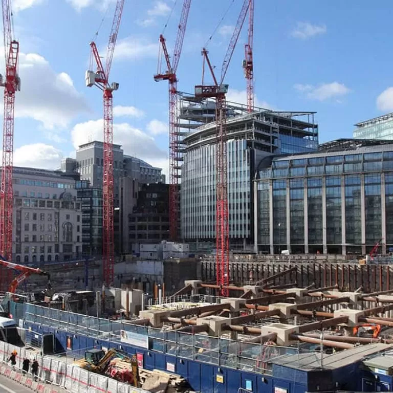
The demolition and construction of buildings, car parks, shopping centres, and office blocks, as well as other major infrastructural developments such as railways, roads, transport, and public areas, are always pertinent to members of the public.
The vast scope of such civil engineering projects that take place in the city are perfectly suited for the capabilities of time-lapse capture.
It’s all in the detail
Given the importance of such works to people both living and visiting cities under development, a visual record can be incredibly useful in as much as it is entertaining.
As you are probably already aware of, time-lapse relays progress at a much faster rate than it was captured. A building under construction can be visualised in a matter of seconds, for example, at a mere fraction of the time this would have occurred in reality.
As such, this technique allows for the smallest of details to be magnified, isolated, and emphasised, at a speed at which the changes may be registered by the human eye. This is an incredibly efficient way for contractors and civil engineering companies to illustrate their services, presenting long-term endeavours in a way that is visually compelling.
Any external environment and terrain can be accessed and recorded for the purposes of time-lapse. In spite of harsher weather conditions, a professional camera system functions at peak capacity for as long as is needed so that no detail is missed.
Complex processes, like the one documented in the above video of replacement bridge works near Manchester Airport, can be presented in a way that is accessible through time-lapse. The additional text markers added to the visual matter clearly explain each phase of labour necessary to make such infrastructural improvements a success.
More than this, this form of documentation can accurately represent projects of significant size and scale.
No urban landscape too big
The versatility of time-lapse means that nothing is off limits.
Nowhere is this more apparent than Google’s use of interval photography to track global phenomenons such as climate change. A project of extreme scale, their Google Engine utilises time-lapse to provide satellite imagery and other observational data for analysis.
Combining five million individual satellite images retrieved over the past three decades by five different satellites, the Google Engine have produced 33 aerial mosaics that can be interacted with using search, pan, and zoom functions.
The benefits of this project are far-reaching, enhancing news coverage about global changes and shaping our understanding of the world in which we live, to name only two.
The immersive platform created using these Google-created time-lapses allows for exploration of the levels of urbanisation relative to particular countries around the globe. As shown in the example above, the urban landscape of Dubai has grown significantly since 1997.
The complete picture
What time-lapse is able to communicate faithfully, as well as the incredible detail of city developments, is how this effects the bigger picture. Documenting these changes over the course of time is of great historical note, particularly when tracking the growth of iconic countries/ cities.
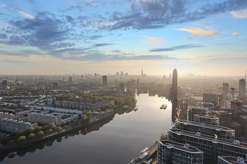
Above: a screenshot from our 360° aerial tour above the whole of the Nine Elms regeneration in the City of London.
Bringing this back to a more local level, an aerial perspective is able to accommodate a much more expansive narrative.
Aerial footage makes for an impressive perspective on the progress of more than one project combined which, when viewed in their entirety, are able to communicate the collective worth of certain developments as situated in their wider context.
Using a drone, the Nine Elms regeneration (shown above) in the heart of London is one such large urban area to be capture in 360°. This comprehensive view is stunning, not only in terms of its HD quality, but also in terms of its interactive function as a complete documentation of London’s ever-changing urban landscape.
As this handful of examples is evidence of, there really is no end to the reasons why it is important and beneficial to record the growth of urban environments, in whatever scale.