News Aerial photography for construction sites
Aerial photography has a history beginning in the mid 19th century but it is only in the last decade that this technology has flourished in the construction industry.
The earliest records of aerial photography were carried out using hot air balloons, or single lined kites. During World War 1 reconnaissance aircraft were equipped with recording equipment to capture enemy movements and defences from above.
Nowadays cameras and video recorders are much more compact and can be securely fixed to unmanned aerial vehicles such as drones. The more basic of this technology is relatively affordable, meaning that almost anyone can try their hand at some form of aerial capture.
Monitoring progress from the skies
In spite of the changing craft used to carry out aerial photography, its uses have remained very much the same since its inception.
Cameras in the skies have given us an unprecedented perspective of our environment and the world we live in. A birds-eye-view has helped us to develop maps, surveillance, our environmental awareness, as well as other, more creative pursuits, such as movie production and commercial advertising.
Taking aerial images of particular stretches of land has also revolutionised how we plan and utilise certain spaces; improvements in technology means that we can see more and in incredible detail.
Plus, land-use projects are now much easier to plan and carry out, as information can be sourced and gathered in a simple and, not to mention, cost effective, way.
Aerial photography for construction
Surveying land in this way is incredibly valuable to the construction industry.
In the early stages of a project, aerial photographs can lend visual support to planning applications. A plan of a building or a series of buildings can be brought to life and more effectively mapped out when visualised in its proposed surrounding context.
Construction site aerial photography is also a useful tool for tracking ongoing building progress.
Traditional surveying methods rely on manpower: with workers mapping the area on foot, a much more more time-consuming process. Flying drones over a construction site is much more time and cost effective as it requires less bodies and can deliver more accurate information.
Progress or change, no matter how small, is easier to discern when recorded with photography. Moreover, aerial pictures can record a larger surface area with more clarity than the human eye. Both of these benefits together facilitate a comprehensive digital mapping of construction progress from start to finish.
Capturing London construction
This perspective is pertinent for considerably large-scale construction projects.
UK capital, London, for instance, has undergone three decades of growth which has reinvented its urban landscape. Now ‘the preeminent global city’, as Laura Parker writes, it is home to 8.8 million residents and is still growing. London construction projects, therefore, are a permanent feature of the city’s landscape.
London is home to several of the largest regeneration projects in Europe. Crossrail and HS2 are utilising billions of pounds to ease congestion for UK rail networks. There will also be more than 500 skyscrapers added to London’s skyline in the next few years.
As part of this regeneration across the City of London, major construction locations, like Nine Elms on the south side of the Thames, are upscaling some of the city’s industrial landmarks into luxury residential and commercial districts.
Photography has been the key to tracking London’s developments. Time-lapse photography, too, is now an increasingly popular mode of capture in UK cities and beyond. Aerial perspectives are ideal in all instances to capture construction progress.

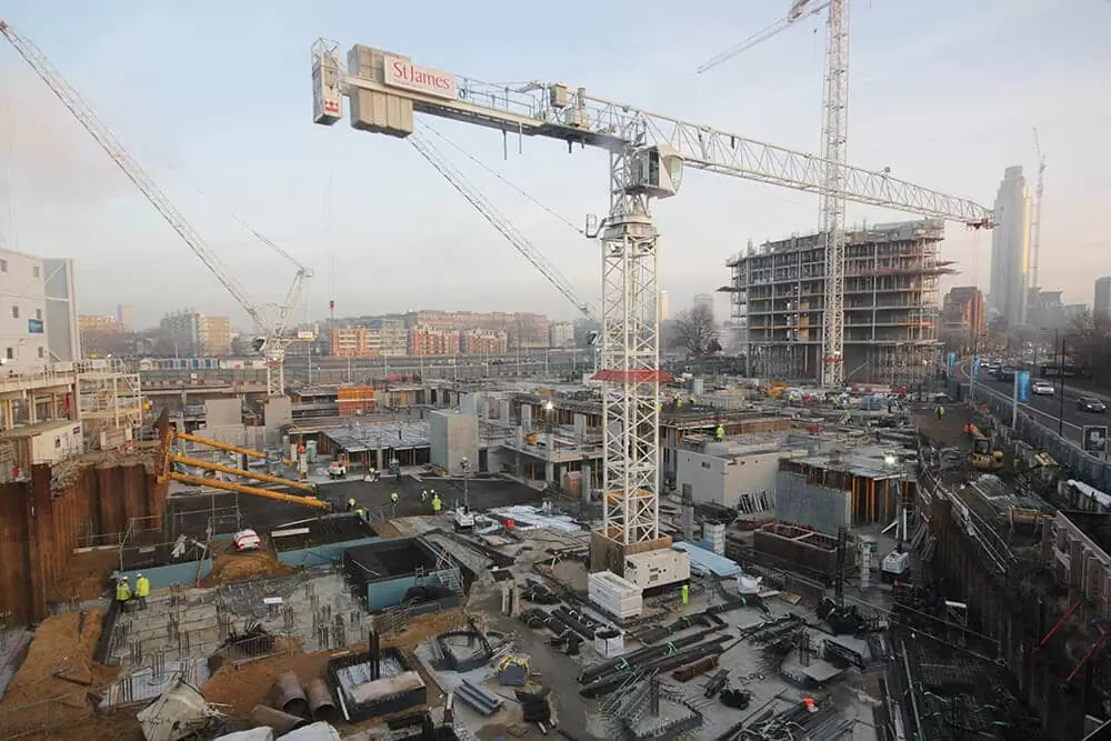
Above: we provided six years of time-lapse photography and construction site monitoring on Riverlight – a major development headed by St James (of Berkeley Group) in the Nine Elms regeneration.
Commissioned to time-lapse the Riverlight development, we utilised multiple camera positions in order to capture a complete account of each key phase of the project, including both demolition and construction.
This also involved moving the time-lapse camera system to the other side of the Thames, so as to capture from the best possible angle.
Major individual projects like Riverlight are collectively driving forward the Nine Elms transformation of an entire district in Central London. Other construction work in this regeneration is 101 Prince of Wales Drive and Battersea Power Station.
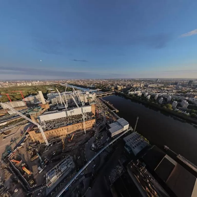
We have also produced a 360° aerial tour showing the Nine Elms area (below) in its entirety, which features all of these construction projects, and more – with Riverlight at the forefront.
[pano file=”https://www.time-lapse-systems.co.uk/wp-content/uploads/panoramas/battersea_aerial_360/index.html”]
Being able to visualise Central London through an aerial perspective like this one exemplifies the the micro and macro benefits of construction aerial photography.
The interactive tour offers a snapshot of construction progress on a large scale, which is, at the same time, the result of a culmination of hundreds of individual developments taking place in this global city.
This also provides a snapshot of how the City of London looks at a particular point in history: how much it has transformed and how much further there is yet to go.
Such a bespoke vantage point can also provide an innovative aesthetic, helping contractors and companies of all sizes to market their construction skills above the rest.
Construction aerial photography is paving the way in this multi-billion£ industry. Whether using UAV or ground-based aerial mast solutions, aerial photography & video is fast becoming an integral part of many media platforms and marketing solutions.